From Orekhovo to Ladoga: a bike route across the Karelian Isthmus along the VT defence line
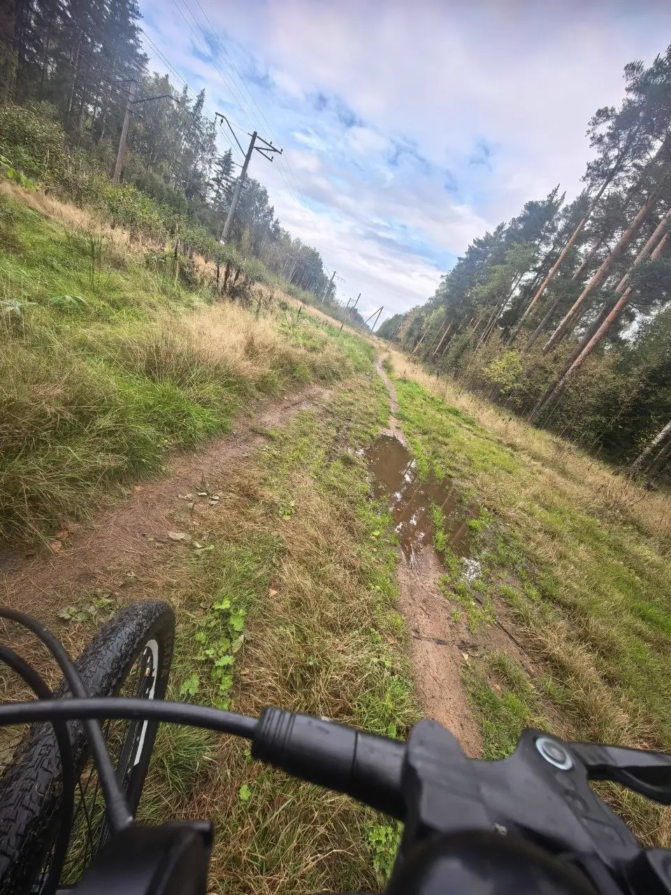
There are routes in Leningrad Region that almost nobody knows about, even though they are official, marked on maps and pass through places where the forest looks as if no one has touched it for a hundred years. 'From Orekhovo to Ladoga' is one of them. Ninety kilometres across the Karelian Isthmus: from Orekhovo station in the south to the Ladoga coast, along the shore, past an old Finnish defence line — and back to platform 69th kilometre.
We rode this route on an e-bike at the end of the season, right after two weeks of pouring rain. And you know what turned out to be the main surprise? The path was dry. Because the soil here is sand.
What this route is
Officially it is a bicycle and pedestrian tourist route 'From Orekhovo to Ladoga', created as part of the Leningrad Region's regional project 'Trail 47' — a programme of ecological routes across the region.
The numbers:
- Total length — 90 kilometres, but it is done in several variants: from 12 to 77 kilometres in one outing
- Time: one to two days by bike, four to five days on foot
- Estimated completion time — 18 hours
- Starts from Orekhovo station in Priozersky District, start point — 60.464110°, 30.262812°
- Route: Orekhovo → forest roads to Dalekaya Bay → north along the Ladoga shore → Reznoy Cape → mouth of the Burnaya River → back to platform 69 km
- Can be done in either direction: you can start from Orekhovo or from the 69th kilometre
- Season — all year round
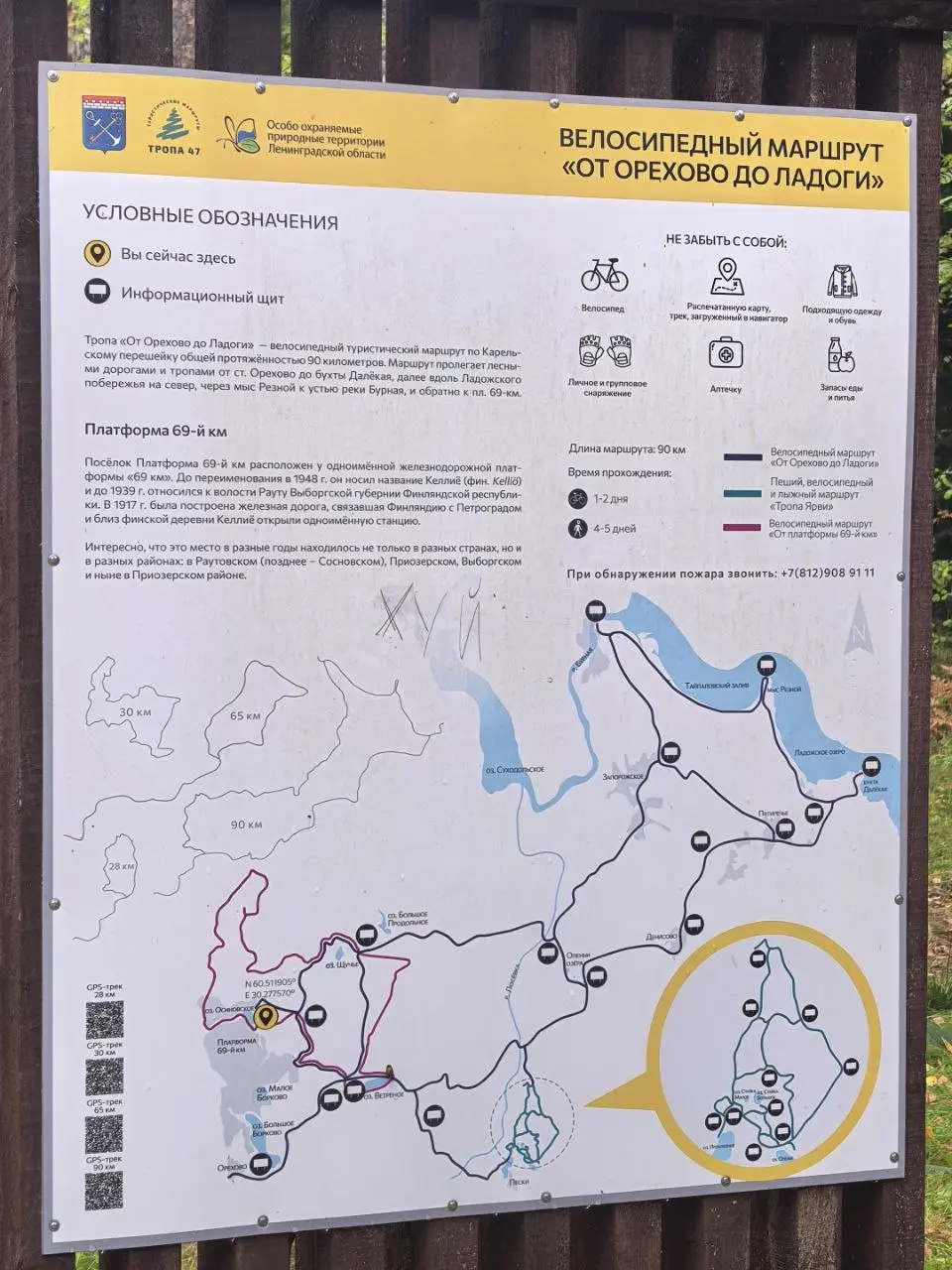
An important point to know in advance: in populated areas the route is not waymarked. That is, in the forest you will see markers, but in villages you will not. The track must be downloaded in advance and put on your phone or navigator. On the information stand on the trail there are four QR codes with GPS tracks for 28, 30, 65 and 90 kilometres — use those as your basis.
How to get there
A suburban train from Finlyandsky railway station to Orekhovo station — this is the Priozersk direction. The journey takes about an hour and a half, and this is one of the reasons the route is convenient for a weekend: you can leave in the morning and be home in the evening.
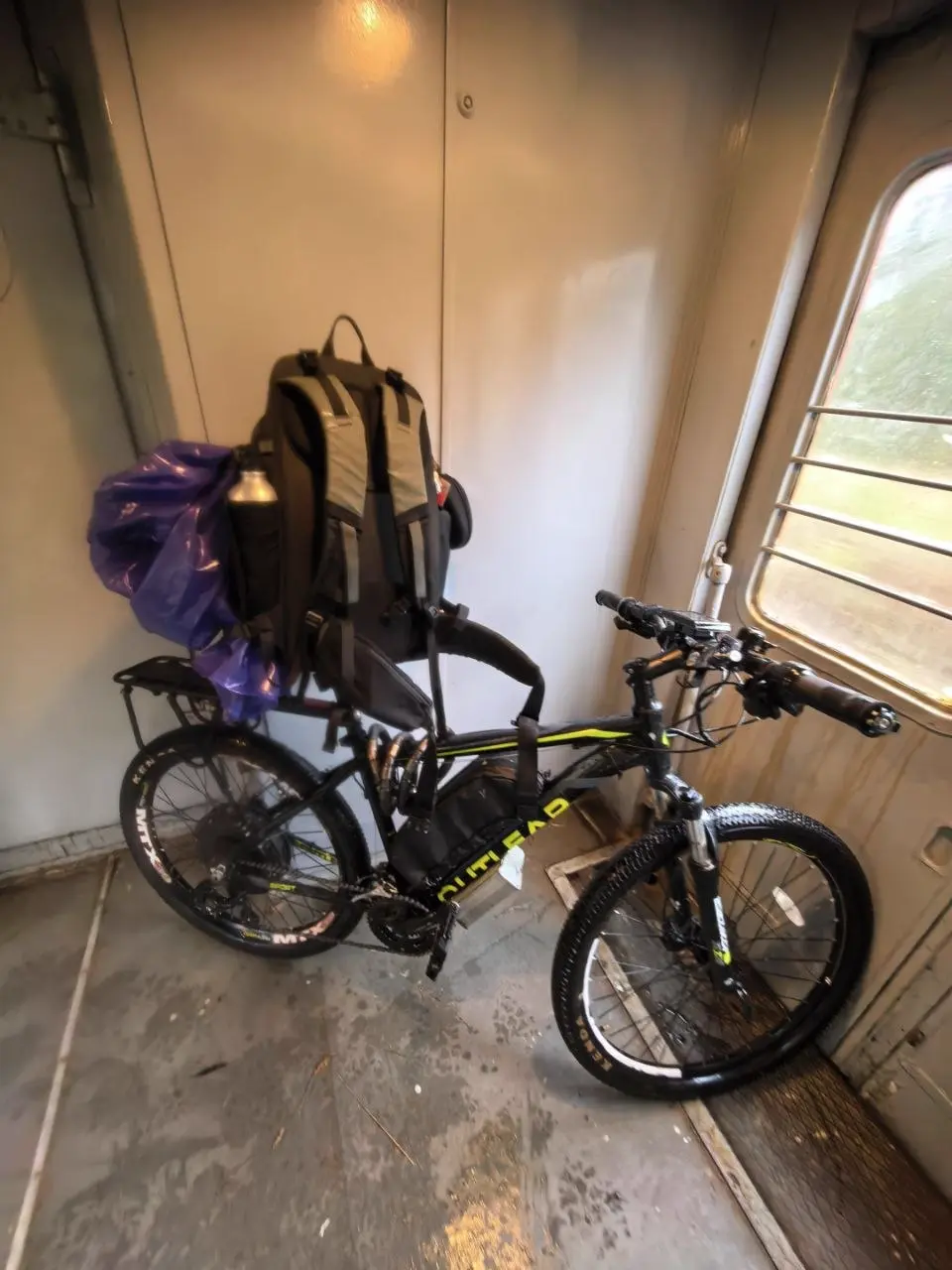
Bicycle on the train. On suburban trains during off-peak hours (from 11:00 to 16:00 and from 21:00 to 06:00) a bicycle is carried free of charge, but you still need to buy a ticket for it at the ticket office. At other times — in the vestibule for an extra fee, one vestibule is designed for one bicycle. It is better to check tariffs and rules with the carrier for the date of travel: they have changed.
A separate plus of Orekhovo village, for which much can be forgiven: right at one of the entrances to the trail there is a 'Pyaterochka' supermarket. On the route this is not a trifle but a strategic resource — you can buy water and food on the spot instead of dragging a backpack from the city.
By the way, about food. The day we rode happened to be Digital Ruble Day, and in that very 'Pyaterochka' we managed to buy meat with digital rubles. It then travelled perfectly to the forest and became dinner on the stove. So that's the route: with a Finnish defence line at the entrance and a digital ruble at the exit.
The VT line: a trail that follows a war
If you ride the route thoughtfully, you begin to notice that the trail does not simply go through forest. It runs along old military lines — and here that is not a figure of speech.
This is the VT line (VT-linja), also known as Vammelsuu–Taipale and the 'Karelian Wall'. It is a Finnish defence line on the Karelian Isthmus, built in 1942–1944 during the Continuation War. It was the third line of Finnish defence and stretched from Vammelsuu northwards — across the very isthmus that a cyclist now rides. In June 1944, during the Vyborg operation, it was breached.
On the maps used by tourists, sections of this line are labelled as VT-line with numbers. You walk along a sandy road, look around — and where it seems to be just 'some bank in the forest', there are actually trenches, communication passages and remains of fortifications from eighty years ago, overgrown with spruce and moss.
For a walk this adds its own nuances: the route stops being just 'forest and lake'. It becomes a conversation with history, and that feeling lasts the whole way.
The road: sand, hills and forest without a map
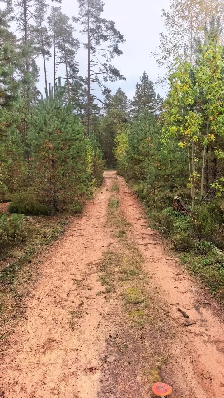
Now about the riding itself.
The trail is wide. Not a path in the bushes but a full-fledged road — a car could drive along it if it really wanted to. But there are no cars here: the area is protected, and you can hear it — it is quiet. You can walk such a road together, talking, freely.
The soil is sand. That is why after two weeks of continuous rain, which locals still remember, the trail remained dry. There are puddles, but few, and they do not turn the route into a mud trial — compared with the south and north of Leningrad Region, here it is surprisingly even and neat. For our region, where any rain usually means knee-deep slush, this is a rare quality.
The terrain is classic Karelian Isthmus. There is a constant micro-relief: hills from 5 to 30 metres high go on endlessly and regularly. You ride and feel as if in a desert — only a desert completely overgrown with spruce. Ascents give way to descents without pauses, and elevation markers do not help: they are simply there.
The forest. The main one is spruce, with tall pines and young fir trees in the undergrowth. Below — bilberry, heather and other small plants that make the forest seem like a continuous green carpet in summer. The pines stand on sandy knolls, and in places it seems this is not the Karelian Isthmus but a piece of the south that has accidentally wandered north.
About the bicycle — honestly. You can ride here on an ordinary bicycle, but it will not be easy: sand and elevation changes require effort, and in places it is easier to walk up the hill. On an e-bike — you ride and smile. If you are wondering which bicycle to take, for this trail the answer is simple.
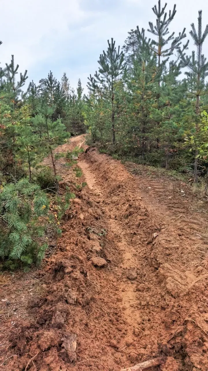
And one find worth sharing. Firebreaks run along the route: the forest is cut by a tractor in strips so that it does not burn. There are many, and you can also move along them — along narrow ones, through which the forest is visible from half a metre away. There is a nuance: these strips are not on maps at all, but in reality they exist and are well passable. If you see a tractor track — you can follow it, but with a navigator and an understanding of where it will lead you. Simply put: such a strip sometimes takes you further than you would like.
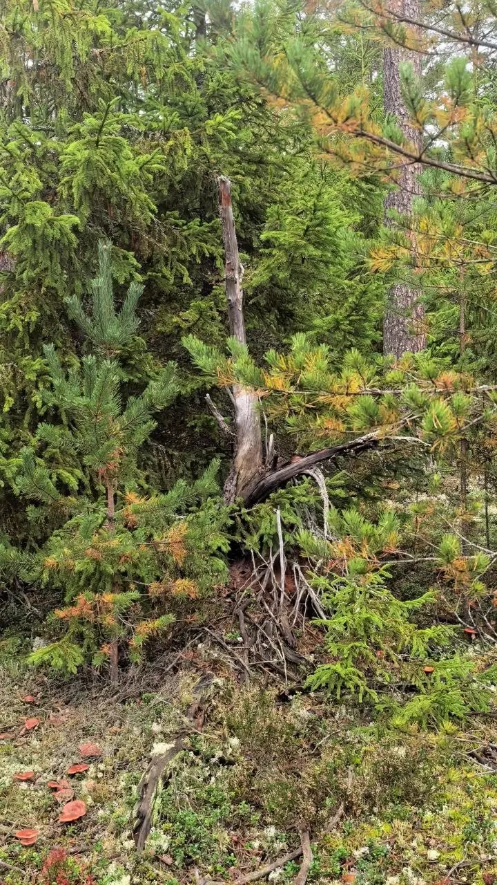
What to see along the way
Orekhovsky Nature Reserve — the very protected area through which the route passes. A regional nature reserve with an area of 9048 hectares, in Priozersky and Vsevolozhsky districts, 37 kilometres north of St Petersburg. Inside — kame hills, fifteen small lakes and pines that are a hundred years old, growing right among granite boulders. The rivers Gladysh, Kozelets, Losevka and Kozhitsa flow through the reserve, and the whole territory is the catchment area of Lake Ladoga.
Campsite at Shchuchye Lake. A pleasant campsite on a slope with a view of the water — and this is part of the route, not a separate attraction. In summer, judging by the cleared spots, there are many people here. The water is clean: you can swim comfortably until the end of August, and for those used to cold — until October. There were no storms in these places, so there are few fallen trees — either nature spared them or they were cleared.
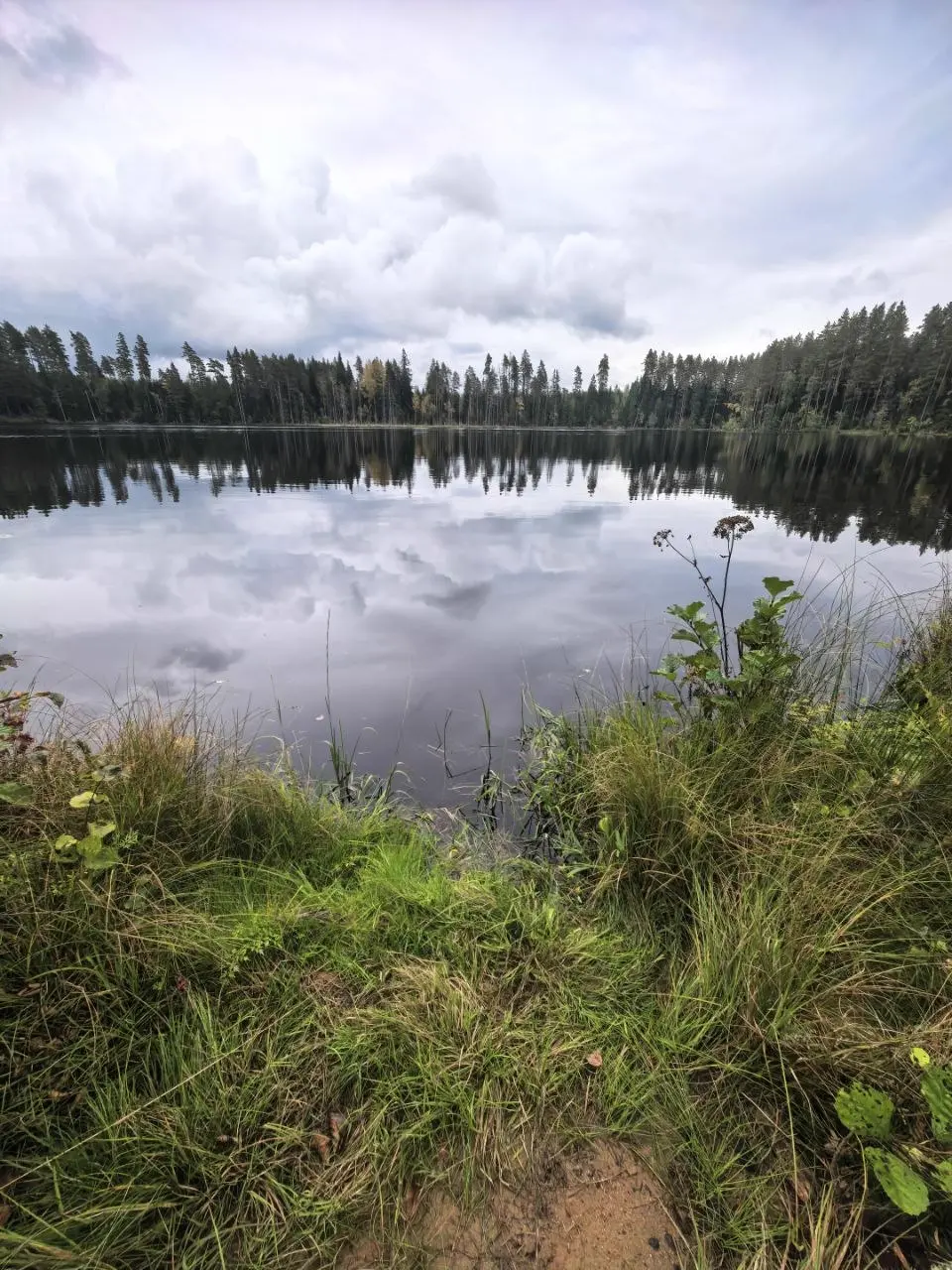
Dalekaya Bay. Here you should look at the bathhouse pier, laid out with giant granite boulders. It starts from the base of the Daleky Peninsula and extends 560 metres into the bay's water area. The structure was built in 1930–1934 to shelter a fishing harbour from storms — and it still works.
Reznoy Cape and Uzky Island. The cape bounds Taipalovsky Bay on the south, and four hundred metres to the north is Uzky Island. A place with history: in 1785 academician Nikolai Ozeretskovsky, a naturalist and member of the St Petersburg Academy of Sciences, visited here.
Platform 69th kilometre. The final point of the route and a place with its own biography. Until 1948 the settlement was called Kelliö, and until 1939 it belonged to the Rautu volost of Vyborg Governorate in Finland. The railway that connected Finland with Petrograd came here in 1917 — that is how the station got its name.
Chashchobnaya Hill — 95 metres above sea level, about a kilometre north-west of Lake Vetrenoye. Formally these are no longer the spurs of the Lembolovskaya Upland but a separate geological story.
Mushrooms, fly agarics and foresters

A separate theme of the route is mushrooms. In the forest you sometimes meet mushroom pickers, and there are quite a few of them. The logic is simple: if so many people come here with baskets, there are mushrooms here. We saw them being collected, and we saw the result.
And there are also unexpectedly many fly agarics here — bright, with white spots, which in the September forest look like decorations. That is also why the forest is worth examining not only at speed but also on foot: on the move you simply will not notice them.
Practicalities
Rain. This deserves a separate mention, because on a hike weather decides everything. Our route was saved from a sudden downpour by an ordinary rubbish area — more precisely, a canopy over containers. When the sky pours everything at once and you are in the forest, any canopy becomes a five-star shelter. So do not neglect infrastructure: canopies, stops, sheds are your friends.
What to take:
- A bicycle, in good order, preferably with wide tyres — sand
- The route track in a navigator (without it there is nothing to navigate by in populated areas)
- First-aid kit and repair kit: you are in the forest, far from a shop
- Water and food: you can buy them in Orekhovo at the entrance to the trail
- Headwear and glasses — branches are low here, protect your eyes
- Raincoat: weather changes quickly
Age and fitness restrictions. Officially the route is recommended for adults and children from 10 years old accompanied by parents. The 77-kilometre variant requires confident cycling and average physical fitness. If you are unsure of your strength — take a short variant, there are several here.
Frequently asked questions
How many kilometres is the route 'From Orekhovo to Ladoga'? Total length — 90 kilometres, but it is done in variants from 12 to 77 kilometres in one outing. In one day it is realistic to do short sections, the full route — in one to two days by bike or four to five days on foot.
How to get to the start? By suburban train from Finlyandsky railway station to Orekhovo station (Priozersk direction), about an hour and a half. With a bicycle it is more convenient to travel during off-peak hours — from 11:00 to 16:00 the bicycle is carried free of charge, but you still need to buy a ticket at the ticket office.
Can you ride the route with a child? Yes, officially it is recommended for adults and children from 10 years old accompanied by parents. There are sections of sandy ground and elevation changes, so for children it is better to choose short variants.
Is the route waymarked? In the forest — yes, in populated areas — no. The track must be downloaded in advance (four variants: 28, 30, 65 and 90 kilometres) and kept in a navigator.
What is the VT line on this route? The Finnish defence line Vammelsuu–Taipale, built in 1942–1944 on the Karelian Isthmus. The route passes along its sections, and on maps they are labelled as VT-line.
Where to swim? At campsites by lakes along the route, including Shchuchye Lake. The water is clean, swimming is comfortable until the end of August, and in a warm autumn — until October. In Ladoga swimming requires caution: the water is colder and the wave can be strong.
When is the best time to go? The route is suitable all year round. The best time for cycling is from May to October; it is the sandy soil that makes it passable even after heavy rain.
Summary
'From Orekhovo to Ladoga' is a rare case when an official route does not disappoint. There is everything people come to Leningrad Region for: sandy roads that you ride as if in a desert, spruce forests with bilberry, lakes with clean water, mushrooms, the Ladoga shore with a granite pier and military history grown into the forest.
The main thing — do not forget the track in your navigator. And allow extra time: here you want to stop more often than you planned.
Photos and videos of the trip
All footage from the route is in a separate gallery: 16 photographs and four short videos from the trail.
View all photos →
Frequently asked questions
Total length — 90 kilometres, but it is done in variants from 12 to 77 kilometres in one outing. In one day it is realistic to do short sections, the full route — in one to two days by bike or four to five days on foot.
By suburban train from Finlyandsky railway station to Orekhovo station (Priozersk direction), about an hour and a half. With a bicycle it is more convenient to travel during off-peak hours — from 11:00 to 16:00 the bicycle is carried free of charge, but you still need to buy a ticket at the ticket office.
Yes, officially it is recommended for adults and children from 10 years old accompanied by parents. There are sections of sandy ground and elevation changes, so for children it is better to choose short variants.
In the forest — yes, in populated areas — no. The track must be downloaded in advance: on the route stand there are four variants — 28, 30, 65 and 90 kilometres.
The Finnish defence line Vammelsuu–Taipale, built in 1942–1944 on the Karelian Isthmus. The route passes along its sections, on maps they are labelled as VT-line. A separate article about the dragon's teeth and trenches of the VT line →
At campsites by lakes along the route, including Shchuchye Lake. The water is clean, comfortable swimming until the end of August, in a warm autumn — until October. In Ladoga the water is colder, and the wave can be strong.
The route is suitable all year round, the best time for cycling is from May to October. The sandy soil makes it passable even after heavy rain.
Related
- Trip photos — 16 photos and videos from the route
- VT line: dragon's teeth and trenches — a military road, granite dragon's teeth and trenches you can walk through
- What to take on a weekend bike trip — 15 things with prices and how to assemble the kit
- Where to go for a weekend from St Petersburg — other weekend routes
- All routes in St Petersburg and Leningrad Region
Route map
- Orekhovo station — start — Suburban train from Finlyandsky railway station, 1 h 20 min. Shop at the entrance to the trail
- Osinovskoye Lake — Lake of the Orekhovsky reserve on the way to Shchuchye
- Shchuchye Lake — campsite — Place for camping and swimming, water stays until the end of August
- Orekhovsky Nature Reserve — Specially protected natural area of Leningrad Region
- Platform 69th km — finish — Nikitino stop (69 km), suburban train back to the city
- Dalekaya Bay — access to Ladoga — Ladoga shore and Bathhouse pier: a 560 m dam of granite boulders, 1930–1934, with a lighthouse at the end
- Reznoy Cape — The northernmost section: the route goes along the Ladoga shore, from here it returns to the finish
Points — according to OpenStreetMap data. Start — Orekhovo station, finish — platform 69th km (Nikitino stop). Maps — © OpenStreetMap contributors.
Separate materials in the cluster
- Vyaryamyanselka Ridge — reserve, eco-trails and four official entrances to routes
- Orekhovsky Nature Reserve — 9048 ha, borders, lakes and the official start of the route
- Nikitino (69 km) — platform at the finish of the route: timetable, prices, bicycle carriage
- Dalekaya Bay — Bathhouse pier, lighthouse and campsite on the western shore of Ladoga
Trip videos
Frequently asked questions
How many kilometres is the route 'From Orekhovo to Ladoga'?
Total length — 90 kilometres, but it is done in variants from 12 to 77 kilometres in one outing. In one day it is realistic to do short sections, the full route — in one to two days by bike or four to five days on foot.
How to get to the start?
By suburban train from Finlyandsky railway station to Orekhovo station (Priozersk direction), about an hour and a half. With a bicycle it is more convenient to travel during off-peak hours — from 11:00 to 16:00 the bicycle is carried free of charge, but you still need to buy a ticket at the ticket office.
Can you ride the route with a child?
Yes, officially it is recommended for adults and children from 10 years old accompanied by parents. There are sections of sandy ground and elevation changes, so for children it is better to choose short variants.
Is the route waymarked?
In the forest — yes, in populated areas — no. The track must be downloaded in advance: on the route stand there are four variants — 28, 30, 65 and 90 kilometres.
What is the VT line on this route?
The Finnish defence line Vammelsuu–Taipale, built in 1942–1944 on the Karelian Isthmus. The route passes along its sections, on maps they are labelled as VT-line. A separate article about the dragon's teeth and trenches of the VT line →
Where to swim?
At campsites by lakes along the route, including Shchuchye Lake. The water is clean, comfortable swimming until the end of August, in a warm autumn — until October. In Ladoga the water is colder, and the wave can be strong.
When is the best time to go?
The route is suitable all year round, the best time for cycling is from May to October. The sandy soil makes it passable even after heavy rain.
Route map
- — Suburban train from Finlyandsky railway station, 1 h 20 min. Shop at the entrance to the trail
- — Lake of the Orekhovsky reserve on the way to Shchuchye
- — Place for camping and swimming, water stays until the end of August
- — Specially protected natural area of Leningrad Region
- — Nikitino stop (69 km), suburban train back to the city
- — Ladoga shore and Bathhouse pier: a 560 m dam of granite boulders, 1930–1934, with a lighthouse at the end
- — The northernmost section: the route goes along the Ladoga shore, from here it returns to the finish
Points are from OpenStreetMap. Maps — © OpenStreetMap contributors.