Vyaryamyanselka Ridge: Nature Reserve, Trails, and Entrances
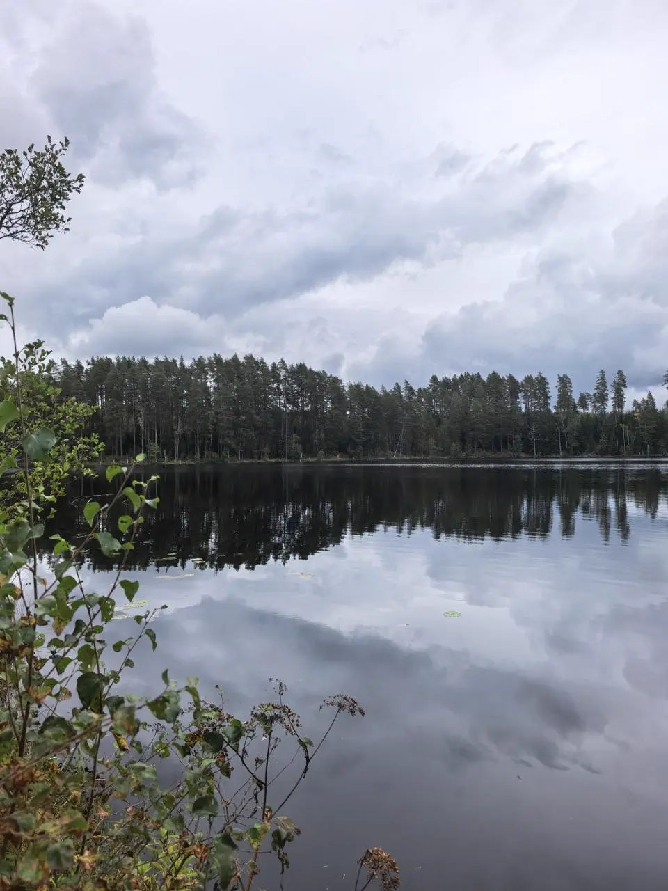
Vyaryamyanselka Ridge is a hilly upland in the central part of the Karelian Isthmus, between Priozersk and Vsevolozhsk. Within it lies a network of lakes, pine forests on sandy slopes, and several official nature trails that are used year-round. For a day trip, this is perhaps the most convenient large natural area in the district: from the commuter train to water and forest is a couple of kilometers on foot.
What This Territory Is
The ridge has the status of a state complex nature reserve of regional significance. It covers 7613.5 ha, of which 823.7 ha are lake waters, meaning roughly a tenth of the area is occupied by water.
| Parameter | Value |
|---|---|
| Status | complex nature reserve of regional significance |
| District | Priozersky District of Leningrad Oblast |
| Area | 7613.5 ha, including 823.7 ha of water |
| Center of territory | 60.6093 / 30.0050 |
| Boundaries | 60.5845–60.6341 N, 29.7607–30.2492 E |
There are two versions in sources about the date of establishment, and I give both: in 1976 the ridge received the status of a natural monument, and it became a nature reserve in 1996—by decree No. 494. If you refer to the age of protection, it is safer to say 'protected since 1976, reserve status since 1996'.
Why People Go There
The main draw here is water and terrain. The ridge is composed of glacial deposits, so the slopes are noticeably steeper than on the flat parts of the isthmus, and between the hills lie lakes of various sizes—from small forest lakes to ones along which you can walk along the shore for hours. Pine forests stand on sand, so after rain it is not as muddy as on the clay roads further south.
The second motive is silence. Even on a weekend, if you walk a couple of kilometers from the entrance, you hardly meet anyone: the territory is large, and the trails are spread across different sections.
Four Official Entrances to the Nature Trails
The Directorate of Protected Areas of Leningrad Oblast describes several routes with starting points. Here are the coordinates worth entering into your navigator in advance:
| Entrance | Coordinates | What's Nearby |
|---|---|---|
| 'Petyayarvi' | 60.630712 / 30.121428 | northern part, closer to Priozersk |
| 'Lake Svetloye' | 60.589286 / 29.887539 | western part, the westernmost entrance |
| 'Lake Berestovoye' (I) | 60.614280 / 30.068825 | central part |
| 'Lake Berestovoye' (II) | 60.601805 / 29.935553 | southwestern part |
The names of the entrances coincide with the names of the lakes near which they are located. The practical point is this: choose an entrance not by the beauty of the name, but by the commuter train that is more convenient for you—the spread in longitude here is almost 40 km, and no one walks between these points.
How to Get There
The nearest stops are Petyayarvi platform and stations on the Priozersk direction. The 'Petyayarvi' entrance is practically at the platform; to the others from the railway you have to walk further—from 3 to 8 km on forest and dirt roads.
- **By commuter train.** From Finland Station towards Priozersk; get off at Petyayarvi—this is the stop closest to the territory.
- **By car.** Via Priozerskoye Highway, then on dirt roads to a specific entrance. There is no asphalt within the territory.
- **By bicycle.** A logical option for this geometry: the entrances are far apart, and a bicycle covers that difference without losing a day.
Map
- Entrance 'Petyayarvi' — northern part
- Entrance 'Lake Svetloye' — west, the farthest entrance
- Entrance 'Lake Berestovoye' I — center
- Entrance 'Lake Berestovoye' II — southwest
- Center of the ridge — according to OSM data
Starting points of the nature trails—according to the Directorate of Protected Areas of Leningrad Oblast. Maps—© OpenStreetMap contributors.
What to Know in Advance
- **This is a protected area.** The visiting rules of the reserve should be checked with the Directorate of Protected Areas of Leningrad Oblast before your trip: they concern camping, fires, and behavior near water.
- **Connection is unstable.** Between the hills, mobile internet disappears, and the spread of entrances is large. It is better to download the navigator and map in advance.
- **No shops.** Take everything with you, including water; the nearest food stores are in settlements along Priozerskoye Highway.
- **Seasonality.** The trails are passable year-round, but in spring and after long rains the lowlands between the hills flood—waterproof footwear is needed.
This is not a campsite but a nature reserve. The procedure for camping is determined by protected area rules, not by the convenience of a spot, so the answer should be obtained from the Directorate of Protected Areas of Leningrad Oblast—there is no single 'blanket' permit here.
For a full day: travel from St Petersburg, 8–15 km within the territory with stops at lakes, and the return commuter train. Half a day is enough if you walk from Petyayarvi and return the same way.
Waterproof footwear and a windproof layer are essential. The rest depends on the season: in summer there are many mosquitoes and horseflies, in spring and autumn the lowlands flood.
The lakes within the territory are there for that—the water warms up by mid-summer. But these are forest lakes without equipped beaches, lifeguard stations, or changing rooms.
How This Relates to the Route 'From Orekhovo to Ladoga'
Vyaryamyanselka lies north of that route: it goes from Orekhovo station to Ladoga through the 'Orekhovsky' reserve, while the ridge begins further up the Priozersk direction. It is worth planning these as two separate trips, not one—a single day for both the route to Ladoga and the ridge is impossible even theoretically.
Related
- Route 'From Orekhovo to Ladoga'—90 km across the Karelian Isthmus: route, transport, photos
- 'Orekhovsky' Reserve—9048 ha around the route, start at Orekhovo station
- Nikolskoye (69 km)—the platform where the route ends: schedule and prices
- Dalnyaya Bay—Banny Pier, lighthouse, and campsite on the western shore of Ladoga
- Trip photos—16 shots and 4 videos from the route
Frequently asked questions
Can I pitch a tent here?
This is not a campsite but a nature reserve. The procedure for camping is determined by protected area rules, not by the convenience of a spot, so the answer should be obtained from the Directorate of Protected Areas of Leningrad Oblast—there is no single 'blanket' permit here.
How much time should I allow?
For a full day: travel from St Petersburg, 8–15 km within the territory with stops at lakes, and the return commuter train. Half a day is enough if you walk from Petyayarvi and return the same way.
What should I wear?
Waterproof footwear and a windproof layer are essential. The rest depends on the season: in summer there are many mosquitoes and horseflies, in spring and autumn the lowlands flood.
Is there anywhere to swim?
The lakes within the territory are there for that—the water warms up by mid-summer. But these are forest lakes without equipped beaches, lifeguard stations, or changing rooms.
Route map
- — northern part
- — west, the farthest entrance
- — center
- — southwest
- — according to OSM data
Points are from OpenStreetMap. Maps — © OpenStreetMap contributors.